

Daniel Foliard
Paris Ouest University
It took some time in 1852 to convince the Imam of the Great Mosque of Al-Nuri in Mosul, but James Felix Jones eventually got the permission he needed to climb up the stairs of the famous “hunchback” minaret. It was from this vantage point that Jones, an Indian army surveyor and officer, started to take measurements. He established the leaning minaret’s longitude and latitude, one of the first fixed points from which it became possible to triangulate the plain of Al-Iraq and to begin an accurate mapping of the area with mixed results (fig.1).
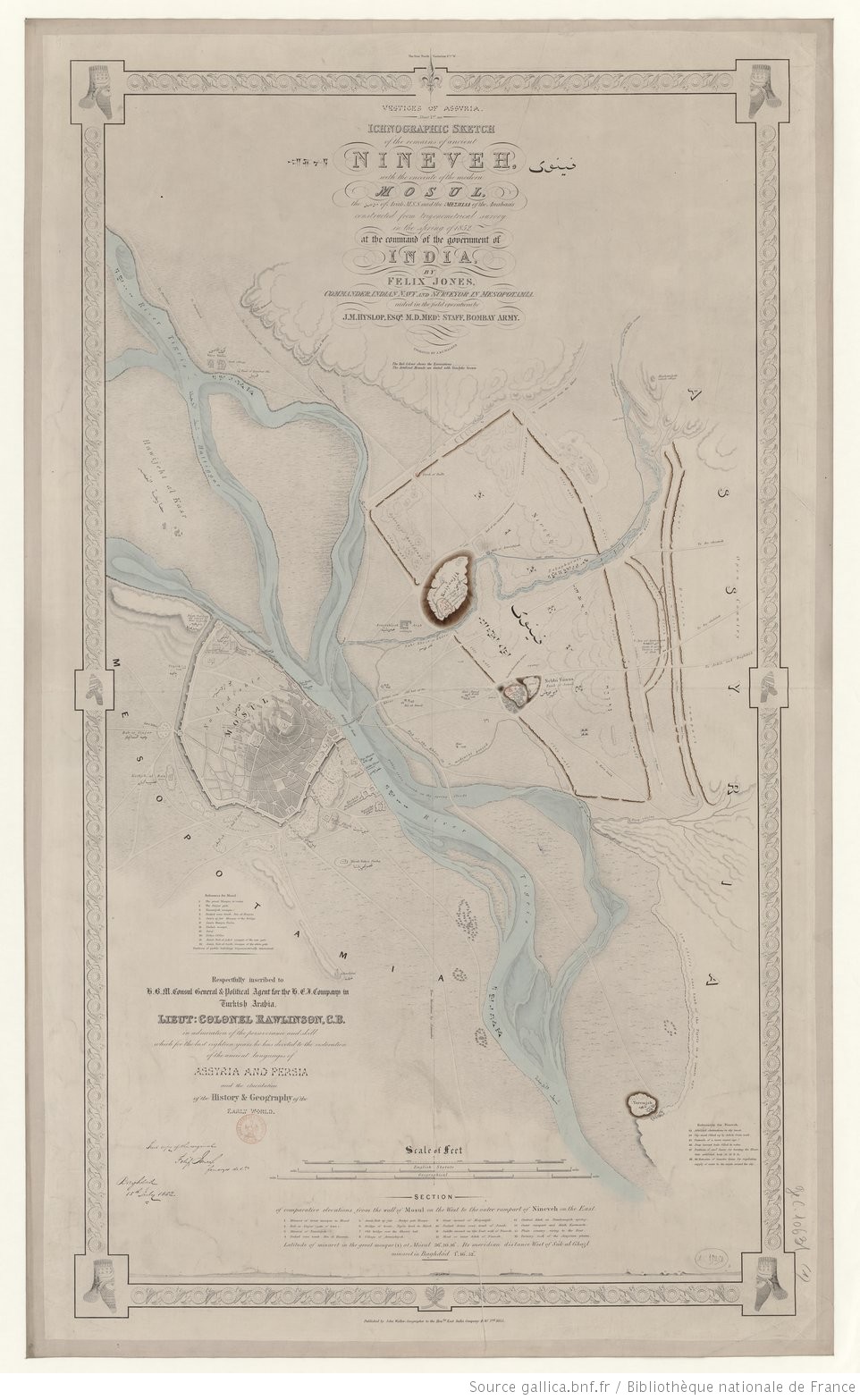
In the early 1850s, Mesopotamia stood in the middle of the overland route to India and, surprisingly, no reliable map of this territory existed until Jones published an account in 1855.[1] Austen Henry Layard’s discovery of Nineveh in the mid-1840s and Francis R. Chesney’s exploration of the Tigris and the Euphrates a decade before had helped placing the area from a European standpoint, but, all in all, many in France or Britain failed to grasp the geography of the Ottoman province. Some of Jones’s original maps were even lost in India and his pioneering work partly forgotten: a testimony to the disorderly nature of Western knowledge in the area. Continue reading “Of Maps and Empire: Charting an Evasive East”

You must be logged in to post a comment.